Estimated reading time 2 minutes, 58 seconds.
Canada’s RADARSAT Constellation Mission (RCM) was launched successfully into space aboard a SpaceX Falcon 9 rocket at 10:17 a.m. eastern time on June 12 from Vandenberg Air Force Base, Calif.
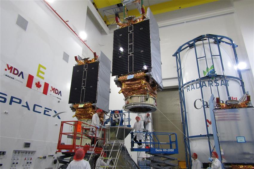
The constellation of three satellites will provide daily images of Canada’s vast territory and maritime approaches, as well as images of the Arctic, up to four times a day. It will have daily access to 90 per cent of the world’s surface. The RCM is also equipped with an automatic identification system (AIS), allowing improved detection and tracking of ships, including those conducting illegal fishing.
For more than two decades, Canada’s world-leading RADARSAT satellites have been providing scientists, government and industry with crucial and continuous data for a wide variety of uses. The RCM will provide a transformational new capability that will be used by researchers to develop solutions to help better understand our planet and by governments to deliver enhanced and reliable services to Canadians.
RCM data will be used in innovative applications that benefit Canadians, including:
• Monitoring climate change, land use evolution and even human impacts on the environment by highlighting changes over time through composite images.
• Detecting and tracking ships, including those conducting illegal fishing, and helping emergency teams save lives during natural disasters.
• Creating ice maps for safer ship navigation and commercial maritime transportation.
• Monitoring the integrity of infrastructure like highways, bridges and railway corridors.
• Measuring changes in permafrost and ground movement to support northern communities, build houses and infrastructure safely, and plan airport runways and their operation and maintenance.
• Maximizing crop yields for farmers while reducing energy consumption and the use of potential pollutants.
• Supporting the operations of the Canadian Armed Forces to further global peace and security.
We need high-quality data to make evidence-based decisions. The RADARSAT Constellation Mission will provide improved data for the critical services our government provides to Canadians, including monitoring climate change, protecting the health of our oceans, forests and crops; and supporting our first responders’ disaster relief efforts,” said Navdeep Bains, minister of innovation, science and economic development